LARCH HILLS NORDIC SOCIETY
Trail Maps
Find your route. Download a map before you head out.
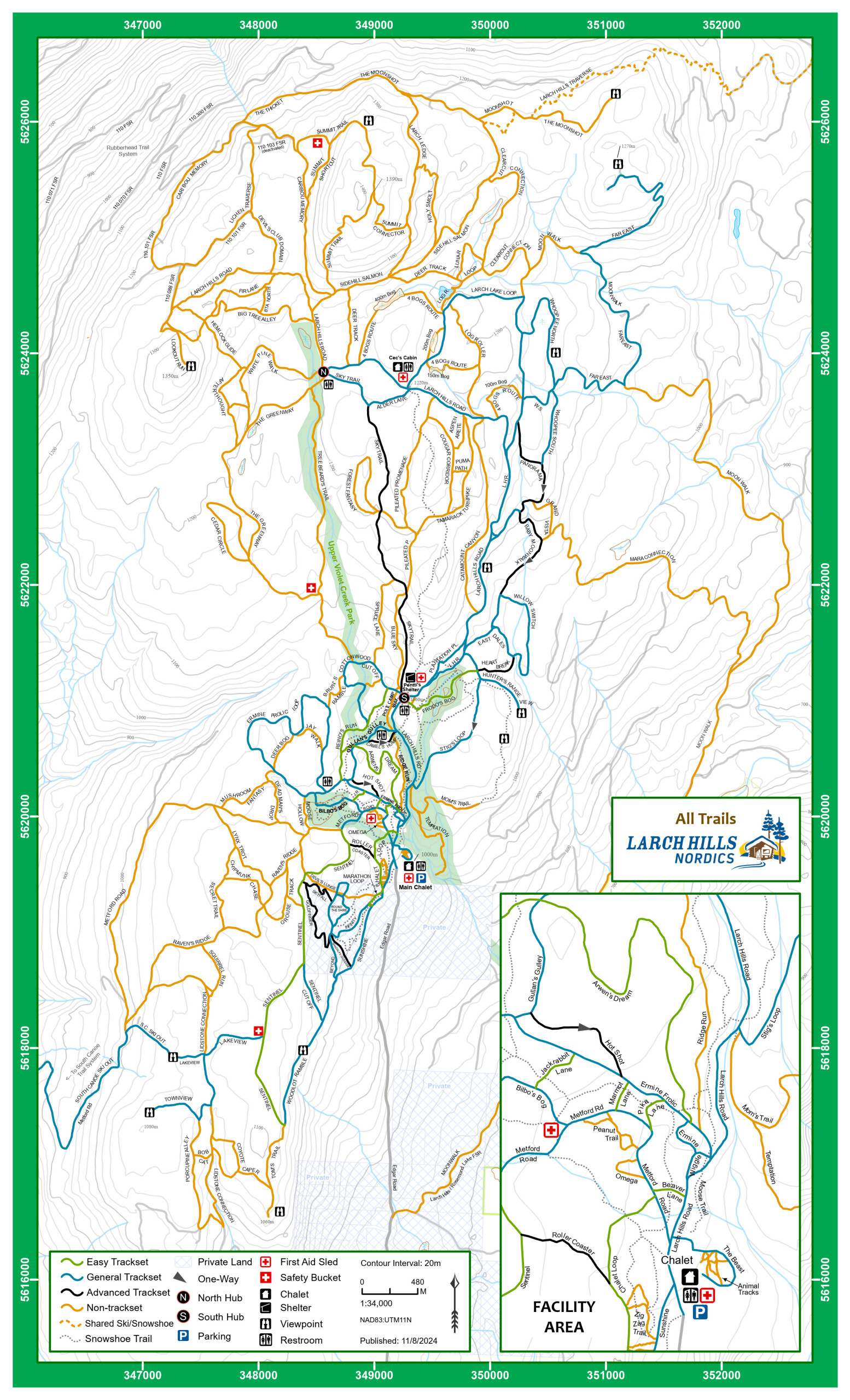
SKI TRAIL MAPS

SUMMER TRAIL MAPS

A big thank you to Suzanne Fordyce at the CSRD for the creation of many of the above maps.

LARCH HILLS NORDIC SOCIETY
Find your route. Download a map before you head out.
A big thank you to Suzanne Fordyce at the CSRD for the creation of many of the above maps.
info@skilarchhills.ca
236-586-5711
Physical Address:
605 Edgar Road,
Salmon Arm, BC, V1E 2Y2
Mailing Address:
Box 218
Salmon Arm, BC, V1E 4N3
When the snow arrives – usually early December until the snow leaves – usually the end of March.
Chalet
Daily 8:00 AM- 10:00 PM
Lit Trails
5:30 AM- Dawn
Dusk – 10:00 PM
Office Hours
9:00 AM – 3:00 PM